Official tourism website for Mourne Mountains and Ring of Gullion
En

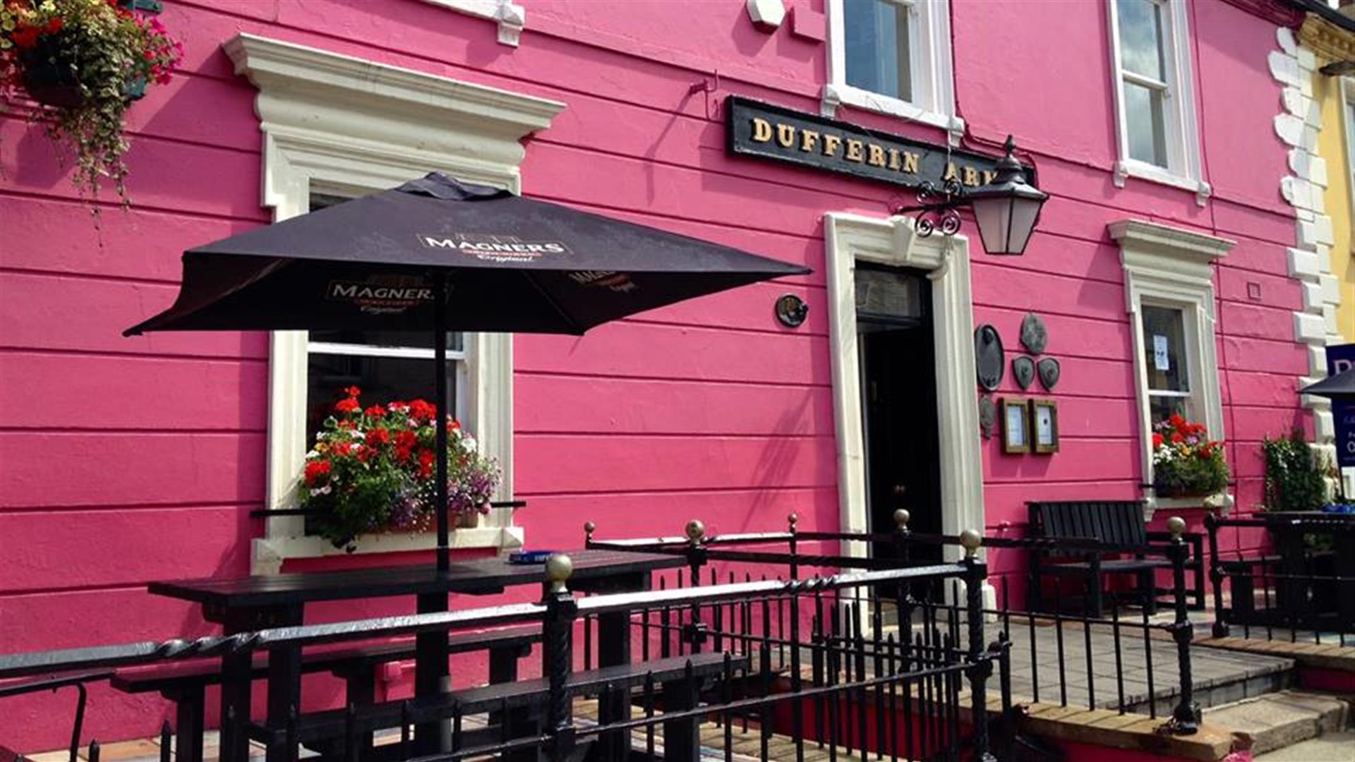
Dufferin Arms

35 High Street, Killyleagh, County Down, BT30 9QF
Dufferin Arms

About

The Dufferin Arms stands at the top of the High Street which is bordered at one end by Killyleagh's fairytale castle and at the other by Strangford Lough.

Both the pub menu and restaurant menu take full advantage of what the local area has to offer with fresh lobster, langoustines and other fruits of the sea which has impressed Rick Stein on his visits.

Prime cuts of fresh beef and lamb are used in conjunction with local game in season, pigeon, pheasant and partridge from the surrounding countryside and also venison from neighbouring Finnebrogue estate. All freshly prepared these are delights not to miss. Also on offer are our very popular Beef & Bird Sharing Platter and Dufferin Seafood sharing platters.

Facilities

Children & Infants

  • Highchairs Available

Payment Methods

  • All major credit/debit cards accepted

TripAdvisor Traveller Rating

TripAdvisor Traveller Rating - 212 reviews212 reviews

Add Dufferin Arms to your Itinerary

Close window

Call direct on:

Tel +44 (0) 28 4482 1182

Map & Directions

Opening Times

* Monday - Saturday 12:00 - 21:00
Sunday 12:00 - 20:00

What's Nearby

  1. The Centre consists of a small museum, numerous displays, a science education area, a…

    0.04 miles away
  2. The imposing Strangford Stone is the tallest megalith in the British Isles.  It was…

    1.4 miles away
  3. Situated on the shores of Strangford Lough in an area of outstanding natural…

    1.64 miles away
  1. Restored ruins of a sixth century church of St. Tassach, said to have given the last…

    3.22 miles away
  2. The castle dates probably from around the 15th century, but the early history is unknown.…

    3.55 miles away
  3. Discover a place of contrasts and creativity at Castle Ward, an eccentric 18th century…

    3.7 miles away
  4. The Reserve provides a relaxing natural retreat and offers visitors tranquil riverside…

    4.04 miles away
  5. Two miles outside Downpatrick is the replica of St Patrick's first church in Ireland.…

    4.14 miles away
  6. Strangford Lough  is located in an Area of Outstanding Natural Beauty and is almost fully…

    4.49 miles away
  7. Struell Wells was built around a stream flowing through a secluded valley. It was a…

    5.43 miles away
  8. Located on the north bank of the Quoile River, Inch Abbey was founded by John de Courcy…

    5.45 miles away
  9. Cloghy Rocks is a wonderful location as a number of seals are often spotted here. There…

    5.53 miles away
  10. The Strangford Lough and Lecale AONB boasts stunning landscapes and includes one of the…

    5.58 miles away
  11. Built 1954 to the designs of S. McIlveen of Ferguson and McIlveen, Belfast. This is a…

    5.62 miles away
  12. Located in the heart of Downpatrick, Down Arts Centre is the operational base for the…

    5.61 miles away
  13. Down County Museum is located in the old county Gaol of Down. It houses fascinating…

    5.7 miles away
Previous Next

Map & Directions

Road Directions

Directions from Town:
From Belfast City Centre take the A22 to Downpatrick, approximately 18 miles.

View Maps and Visitor Guides
View what the Mourne Mountains & Ring of Gullion has to offer and some of the best things to see and do during a visit.
E-newsletter sign up
Sign up for the Mourne Mountains & Ring of Gullion newsletter for inspiration and travel tips.
Back to Top

Visit Mourne

Tourism Northern Ireland

Geopark

Don't Miss