Official tourism website for Mourne Mountains and Ring of Gullion
En

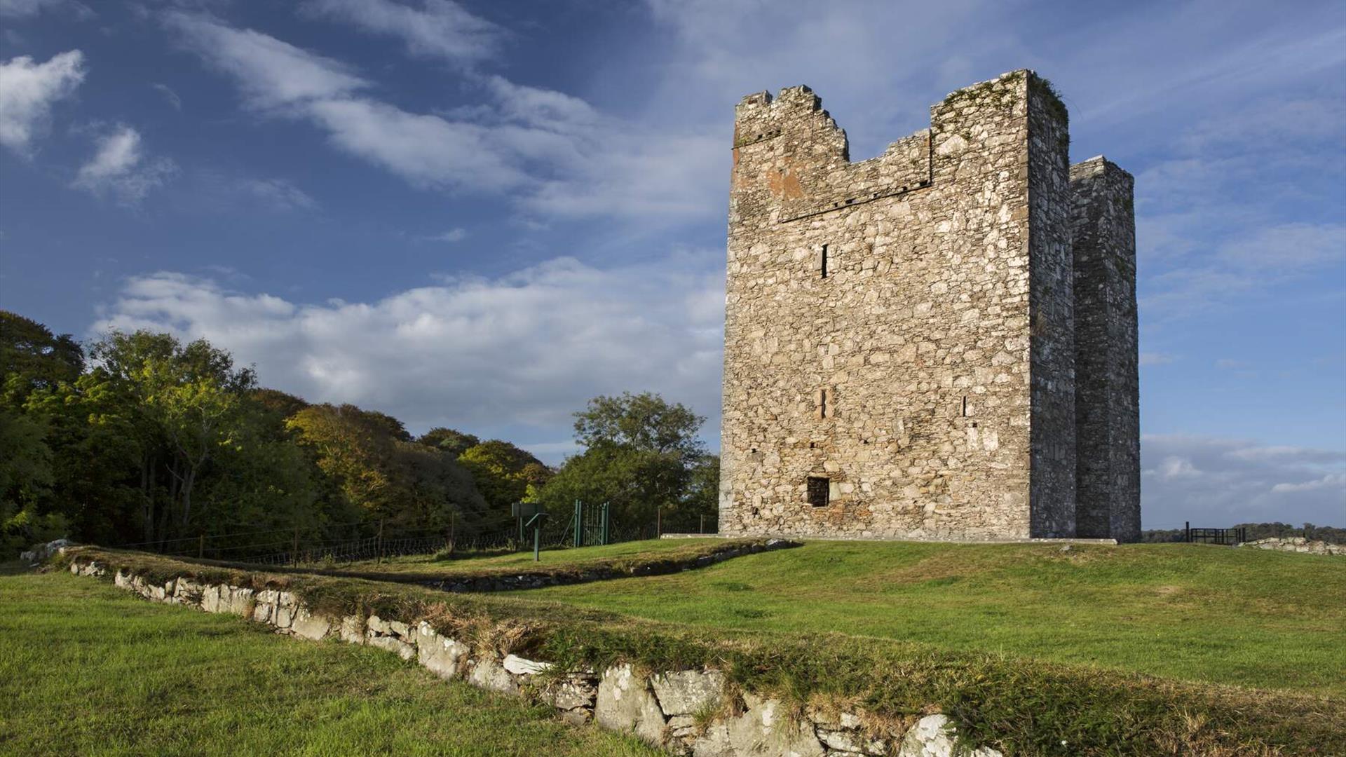
Audley's Castle

Audleystown Road, Portloughan, Strangford, County Down, BT30 7LP
Audley's Castle

Book Tickets Online

About

The castle is named after its late 16th-century owners, the Audleys, an Anglo-Norman family who held land in the area in the 13th century, It was sold, with the surrounding estate, to the Ward family in 1646 and used in 1738 as an eye-catching focus of the long vista along Castle Ward's artificial lake, Temple Water.

The site comprises of a number of paths to allow you to get to the Castle.

Audley's Field was used as a filming location in HBO's epic series Game of Thrones®.

Lots of drama unfolds in Audley's Field and Castle by Strangford Lough. Visit and you can even explore Robb's Trail, one of two Game Of Thrones® self-guided cycling tours provided by Clearsky Adventure Centre in the Castle Ward Estate.

Audley's Field was used during Season 1 as King Robert Baratheon and his retinue arrive at Winterfell. It's the backdrop of Robb's Camp in Season 2 and the place where he first meets Talisa. Later on, Audley's Field is where Alton Lannister is imprisoned with Jaime (and doesn't live to tell the tale).

Universal Pictures filmed several scenes of the Dracula Untold movie at Audleys Field. This was one of many of the locations used for filming across Northern Ireland.

Book Tickets

Guide Prices

Ticket TypeTicket Tariff
TicketFree

Please contact the organiser for any further information that's required.

Add Audley's Castle to your Itinerary

Close window

Call direct on:

Tel +44 (0) 28 9082 3207

Map & Directions

What's Nearby

  1. Discover a place of contrasts and creativity at Castle Ward, an eccentric 18th century…

    0.89 miles away
  2. Strangford Lough  is located in an Area of Outstanding Natural Beauty and is almost fully…

    0.95 miles away
  3. Cloghy Rocks is a wonderful location as a number of seals are often spotted here. There…

    2.37 miles away
  1. Restored ruins of a sixth century church of St. Tassach, said to have given the last…

    2.86 miles away
  2. A picturesque beach on the Narrows of Strangford Lough, Kilclief is a sandy beach with a…

    3.22 miles away
  3. Kilclief Castle was built between 1413 and 1441, reputedly by John Sely, bishop of Down.…

    3.24 miles away
  4. The Centre consists of a small museum, numerous displays, a science education area, a…

    3.51 miles away
  5. The imposing Strangford Stone is the tallest megalith in the British Isles.  It was…

    4.18 miles away
  6. Situated on the shores of Strangford Lough in an area of outstanding natural…

    4.2 miles away
  7. Ballyhornan beach is located on the Lecale Way. To the north is Kilclief and to the south…

    4.36 miles away
  8. Two miles outside Downpatrick is the replica of St Patrick's first church in Ireland.…

    4.99 miles away
  9. The Reserve provides a relaxing natural retreat and offers visitors tranquil riverside…

    5.54 miles away
  10. Struell Wells was built around a stream flowing through a secluded valley. It was a…

    5.72 miles away
  11. The Strangford Lough and Lecale AONB boasts stunning landscapes and includes one of the…

    6.33 miles away
  12. Built 1954 to the designs of S. McIlveen of Ferguson and McIlveen, Belfast. This is a…

    6.68 miles away
  13. Located in the heart of Downpatrick, Down Arts Centre is the operational base for the…

    6.76 miles away
Previous Next

Map & Directions

Road Directions

Directions from Town:Travel along the A7 Belfast Road and head towards Inch Abbey Road. Travel along this road for approximately 500 yards and Audley's Castle is on the left hand side.

View Maps and Visitor Guides
View what the Mourne Mountains & Ring of Gullion has to offer and some of the best things to see and do during a visit.
E-newsletter sign up
Sign up for the Mourne Mountains & Ring of Gullion newsletter for inspiration and travel tips.
Back to Top

Visit Mourne

Tourism Northern Ireland

Geopark

Don't Miss