Official tourism website for Mourne Mountains and Ring of Gullion
En

Rostrevor, County Down

Bridge Street, Rostrevor, NEWRY, County Down, BT34 3BG
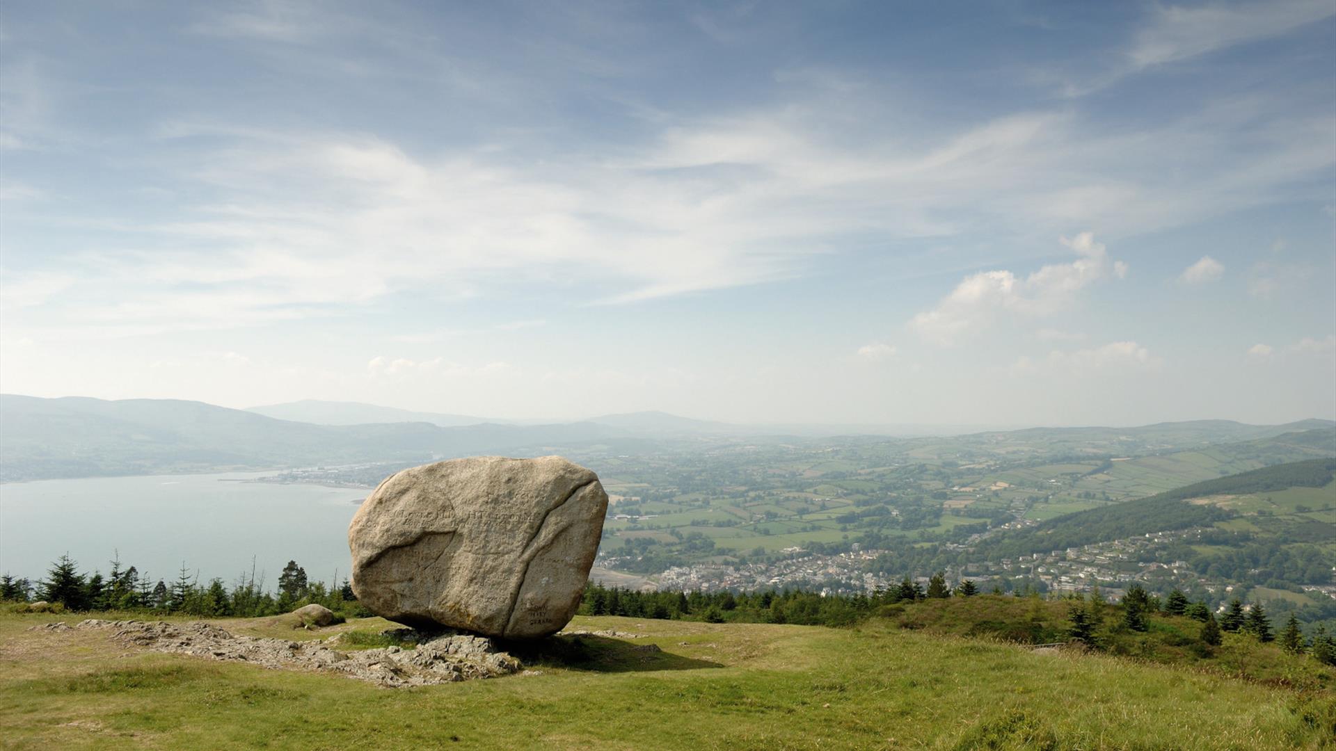
View from the Cloughmore Stone

About

Rostrevor, a picturesque village, lies at the southern entrance to the Mournes and along the shores of Carlingford Lough. In 1612 Sir Edward Trevor married Rose Ussher, daughter of the Archbishop of Armagh and it is said that he named the village after his new young wife.

The village has a number of beautiful walks through Rostrevor Forest and Kilbroney Park. Rostrevor is an area of historical interest and has lots of associated folklore.  On the slopes of Slieve Martin in Kilbroney Park you will find the ‘Big Stone’ (Cloc Mor, anglicized to Cloughmore). St Bronagh’s 6th Century Church and Bell and Giant Murphy’s Grave are also located in the village. The imposing Ross Monument on Shore Road was erected in 1826 (restored 2008) to honour Major General Robert Ross who fought in both Europe and America. It was also to celebrate a victory over the American forces at Bladensburg. Kilfeaghan Dolmen, situated approximately three miles from Rostrevor on the Kilkeel road, is a Neolithic portal tomb, approximately 5,000 years old. It is well worth a visit because of the massive capstone, which is estimated to weigh 35 tons and believed to be one of the biggest in Ireland. Recent excavations unearthed various bones and pottery.

Whether you are looking for an adventure packed family holiday or a couple's retreat to unwind and reconnect, Rostrevor, County Down is the perfect getaway place.  With a range of fun, action packed activities spread across this picturesque village, you sure won’t be disappointed - or bored for that matter.

Download the Rostrevor Visitor Guide or call into any of the locals shops in Rostrevor and pick up a souvenir copy to share with your family and friends.  

Facilities

Accessibility

  • Designated parking provided for guests with disabilities
  • Toilets for disabled visitors

Children & Infants

  • Children's outdoor play area

Establishment Features

  • Accommodation nearby

Leisure Facilities

  • Outdoor activities

Parking & Transport

  • Car parking

Payment Methods

  • All major credit/debit cards accepted

Provider Preferences

  • Coastal
  • Village Location

Add Rostrevor, County Down to your Itinerary

Close window

Call direct on:

Tel +44 (0) 33 0137 4046

Map & Directions

What's Nearby

  1. Kilbroney Park features riverside walks and an arboretum. There is a two-mile forest…

    0.42 miles away
  2. This beautiful area has superb views and good walking routes over Carlingford Lough.…

    0.63 miles away
  3. 'Cill Bhronaigh', or Bronagh’s Church (12th century), is located in the graveyard just…

    0.9 miles away
  1. Our play farm offers a huge indoor soft play area with four dragon slides and a massive…

    1.7 miles away
  2. Warrenpoint Beach is located alongside the Mourne Mountains on the shores of Carlingford…

    2.08 miles away
  3. Excellent example of a tower-house and bawn built about 1568 at a point where the Newry…

    3.4 miles away
  4. "Where the Mountains of Mourne sweep down to the sea" (Percy French) The popular song has…

    4.28 miles away
  5. Known locally as the ‘King’s Ring’, this court tomb has a prominent position in the…

    5.05 miles away
  6. Commanding the mouth of Carlingford Lough, the Castle has an eventful history. It was…

    5.81 miles away
  7. Cranfield West offers a gently sloping, mainly sandy beach located at the entrance to…

    7.08 miles away
  8. Dating from the Iron Age period around 10 BC, the enclosure comprises two roughly…

    7.48 miles away
  9. Corliss Fort is one of the best-preserved bivallate raths in County Armagh.

    7.48 miles away
  10. Leisleitrim Fort is a fine example of a multivallate rath ( a rath with several banks and…

    7.48 miles away
  11. Bagenal’s Castle located in historic Newry is a 16th century fortified house and…

    7.5 miles away
  12. Kilnassagart Inscribed Stone, in the south of County Armagh, is regarded as being one of…

    7.6 miles away
  13. This is undoubtedly the most commanding building in Newry and is arguably the most…

    7.64 miles away
Previous Next

Map & Directions

View Maps and Visitor Guides
View what the Mourne Mountains & Ring of Gullion has to offer and some of the best things to see and do during a visit.
E-newsletter sign up
Sign up for the Mourne Mountains & Ring of Gullion newsletter for inspiration and travel tips.
Back to Top

Visit Mourne

Tourism Northern Ireland

Geopark

Don't Miss