Official tourism website for Mourne Mountains and Ring of Gullion
En

Kilnasaggart Inscribed Stone

Kilnasaggart Road, Jonesborough, County Armagh, BT35 8JA
Kilnasaggart Inscribed Stone

Book Tickets Online

About

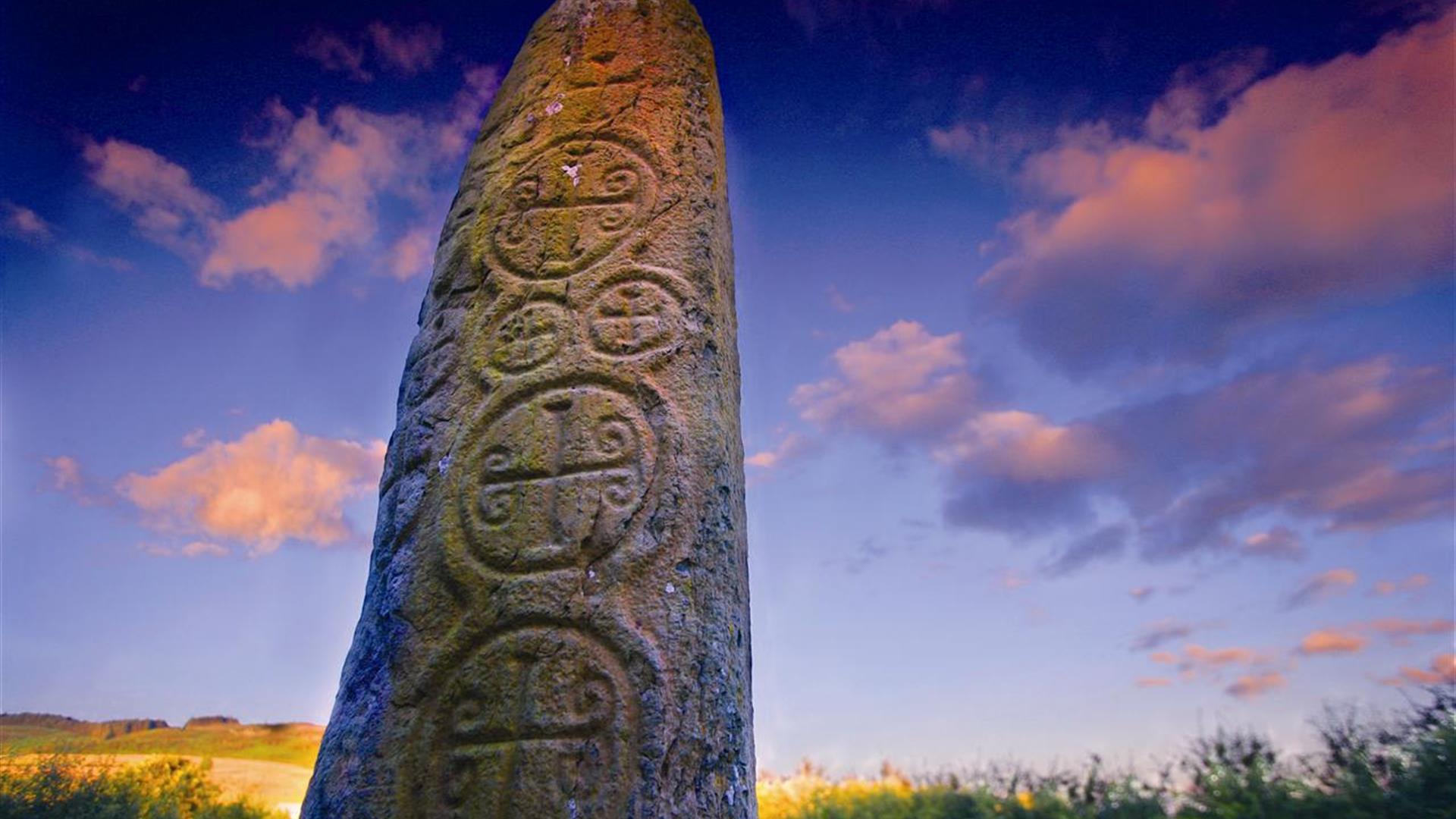
'Cill na Saggart' means the 'church of the priest'. Standing at almost 2m tall, Kilnassagart Inscribed Stone is regarded as being one of the oldest inscribed stones in Ireland. It stands on the ancient road which ran from Tara in County Meath and through the Moyry Pass to Dunseverick Head on the North Antrim Coast (Sighe Midhlachra).

It has a total of 13 crosses on its faces and the inscription, ‘This place, bequeathed by Temoc, son of Ceran Bic, under the patronage of Peter, the Apostle.’ Temoc’s death was recorded around 714, which sets the stone in the 8th century. Excavations at the site in 1966 and 1968 revealed an early Christian graveyard with graves oriented radially around the pillar and facing towards the rising sun. It is thought that a church was probably located nearby.

The Stone can be found 2 kms south of Jonesborough in the townland of Edenappa, close to Moyry Castle and the border with County Louth.

Book Tickets

Facilities

Provider Preferences

  • Free (parking charges may apply)

Guide Prices

Ticket TypeTicket Tariff
TicketFree

Free

Add Kilnasaggart Inscribed Stone to your Itinerary

Close window

Call direct on:

Tel +44 (0) 28 9082 3207

Map & Directions

Opening Times

* All year round

What's Nearby

  1. South of the County Armagh village of Jonesborough lie the ruins of Moyry Castle, built…

    0.3 miles away
  2. Follow Fionn's Giant Adventure (previously known as the Giant's Lair) at Slieve Gullion…

    2.83 miles away
  3. The Slieve Gullion Forest Trail, a magnificent 10km Scenic Forest Drive will be…

    2.83 miles away
  1. Slieve Gullion Forest Park offers the unmissable opportunity to experience tranquil…

    2.83 miles away
  2. Slieve Gullion Forest Park is in the heart of the Ring of Gullion. The Ring of Gullion is…

    2.83 miles away
  3. Slieve Gullion Passage Tomb, dramatically situated on the southern end of the Slieve…

    2.83 miles away
  4. Slieve Gullion is Ireland's Mountain of Mystery. Slieve Gullion Forest Park offers…

    2.83 miles away
  5. Known locally as the ‘King’s Ring’, this court tomb has a prominent position in the…

    3.62 miles away
  6. This unusual megalithic monument is set on the eastern edge of a low ridge, overlooked by…

    3.68 miles away
  7. The site contains two early churches situated back to back. Even earlier, it was the…

    4.65 miles away
  8. Excellent example of a tower-house and bawn built about 1568 at a point where the Newry…

    4.83 miles away
  9. Warrenpoint Beach is located alongside the Mourne Mountains on the shores of Carlingford…

    5.57 miles away
  10. This monument is an extremely well preserved Neolithic burial site with three chambers. …

    5.67 miles away
  11. This Neolithic burial site, dated between 4000 and 2500 BC, has a huge capstone,…

    5.75 miles away
  12. Our play farm offers a huge indoor soft play area with four dragon slides and a massive…

    6.33 miles away
  13. Bagenal’s Castle located in historic Newry is a 16th century fortified house and…

    7.17 miles away
Previous Next

Map & Directions

View Maps and Visitor Guides
View what the Mourne Mountains & Ring of Gullion has to offer and some of the best things to see and do during a visit.
E-newsletter sign up
Sign up for the Mourne Mountains & Ring of Gullion newsletter for inspiration and travel tips.
Back to Top

Visit Mourne

Tourism Northern Ireland

Geopark

Don't Miss