Official tourism website for Mourne Mountains and Ring of Gullion
En

Cloughmore Trail via Fiddler's Green

Newry, Co Down
Cloughmore Trail via Fiddler's Green

Book Tickets Online

About

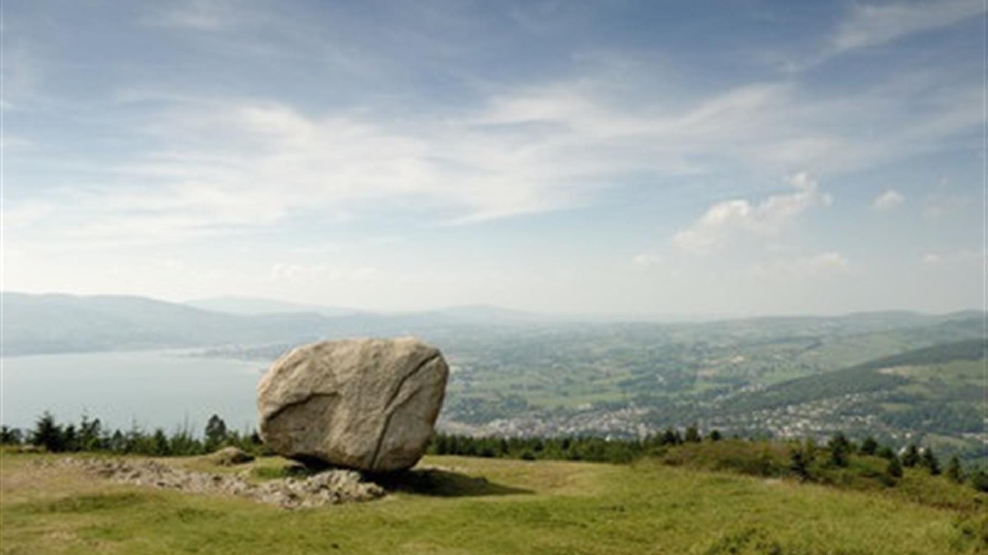
Kilbroney Park, Rostrevor, is situated in a stunning location, where mountain, sea and valley create a scenic wonderland.  Overlooking Carlingford Lough, these 97 acres of beautiful parkland nestle within the shadow of Slieve Martin and the mountains of Mourne.  According to local folklore, the Big Stone was thrown across the lough by Finn McCool during a fight with a giant rival. Follow this trail to the “Chloch Mhór” (Irish for big stone) to enjoy panoramic views across Carlingford Lough and the surrounding landscape.

Start Point:
J195175

Finish Point:
J195175

Route:
This walk starts in the upper car park (way-marker no. 1).  Follow the trail uphill until you reach the big stone (way-marker no.3).  Enjoy the views from this great vantage point before following the way-markers downhill as you make your way to a further viewpoint area before reaching the Fiddler’s Green. The latter, small clearing is located at the southern end of the ancient oakwood and was once a focal point for local entertainment.  This custom is maintained in the annual Fiddler’s Green traditional music festival, which uses the green as well as other venues across the village.  Continue on the trail through the ancient oakwood until you rejoin the main road which leads up past the main car park/café/reception area (way-marker no. 15).  Follow the way-markers as you begin your ascent towards the upper car park, completing this circular route walk.  It is also an option to start and finish from the main car park (way-marker no 15) bearing in mind that when you reach the upper car park and pass way-marker no.22 that the next way-marker will be 1.

Distance:
2.5 miles

Terrain:
Steep inclines, forest tracks, u

Point of interest:
Cloughmore (or the ‘Big Stone’), Fiddler’s Green, ancient Oakwood, natural heritage

Facilities:
Facilities within Kilbroney Park include: Kilbroney Tree Trail, Narnia Trail, Fairy Glen, Mountain Bike Trails, Rostrevor Mountain Bike Centre, Caravan Park, Café, Toilets, Car Park, Children’s Play Park, Adult outdoor gym, ancient Oakwood In addition, there is a wide range of restaurants/cafes/shops in Rostrevor to suit all tastes.

Publication:
You can pick up a copy of the Narnia and Cloughmore Trails brochure at the reception building in Kilbroney or in some of the local businesses. Alternatively, it is available to download.

Nearest town:
Rostrevor

OS map:
29

Map & Directions

What's Nearby

  1. This beautiful area has superb views and good walking routes over Carlingford Lough.…

    0.66 miles away
  2. Kilbroney Park features riverside walks and an arboretum. There is a two-mile forest…

    0.79 miles away
  3. 'Cill Bhronaigh', or Bronagh’s Church (12th century), is located in the graveyard just…

    1.33 miles away
  1. Our play farm offers a huge indoor soft play area with four dragon slides and a massive…

    2.85 miles away
  2. Warrenpoint Beach is located alongside the Mourne Mountains on the shores of Carlingford…

    3.11 miles away
  3. "Where the Mountains of Mourne sweep down to the sea" (Percy French) The popular song has…

    4.48 miles away
  4. Excellent example of a tower-house and bawn built about 1568 at a point where the Newry…

    4.52 miles away
  5. Commanding the mouth of Carlingford Lough, the Castle has an eventful history. It was…

    4.73 miles away
  6. Cranfield West offers a gently sloping, mainly sandy beach located at the entrance to…

    5.99 miles away
  7. Known locally as the ‘King’s Ring’, this court tomb has a prominent position in the…

    6.15 miles away
  8. The Silent Valley Reservoir was built to gather water from the Mourne Mountains and is…

    7.14 miles away
  9. Provides a first class service for visitors to Northern Ireland and for local residents.

    7.35 miles away
  10. The Nautilus Centre overlooks Kilkeel's busy and picturesque fishing port and houses the…

    7.46 miles away
  11. The Electric Brae is a hill at which Newton's discovery, the law of gravity, is defied…

    7.47 miles away
  12. Spelga Dam Reservoir sits in the heart of the Mourne Mountains, located approximately 10…

    7.47 miles away
  13. Indoor Golf Simulators powered by Trackman

    7.81 miles away
Previous Next

Map & Directions

Road Directions

Kilbroney Park is located on the Shore Road (A2) between Rostrevor and Kilkeel. Numbered way-marking posts are in place with way-marker no. 1 being at the upper car park. Alternatively, pedestrian access from the village is via the Fairy Glen entrance to the park.

View Maps and Visitor Guides
View what the Mourne Mountains & Ring of Gullion has to offer and some of the best things to see and do during a visit.
E-newsletter sign up
Sign up for the Mourne Mountains & Ring of Gullion newsletter for inspiration and travel tips.
Back to Top

Visit Mourne

Tourism Northern Ireland

Geopark

Don't Miss