Official tourism website for Mourne Mountains and Ring of Gullion
En

An Radhairc

35 Cloughmore Park, Rostrevor, Co Down, BT34 3AX
An Radhairc

About

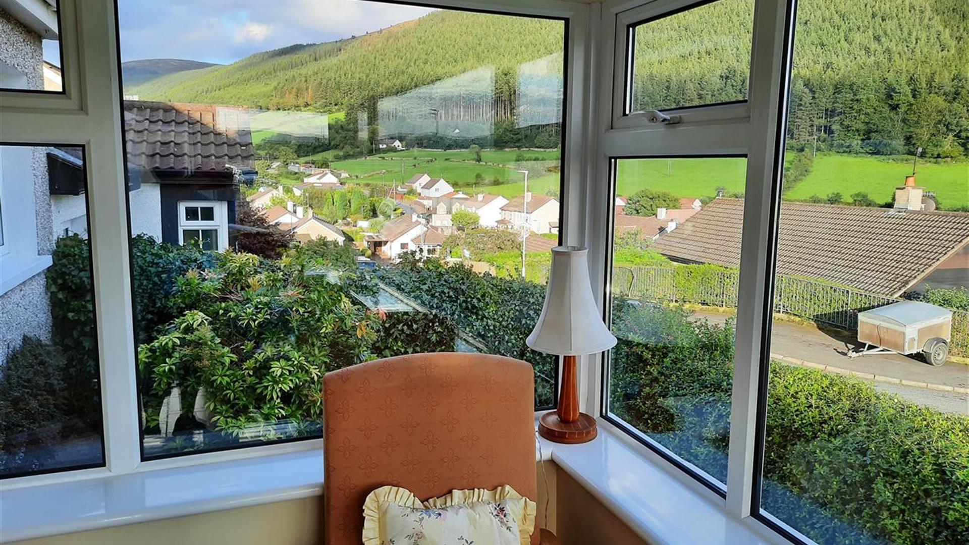
Lying within one mile of Tranquil Rostrevor, An Radhairc provides a panoramic view of the splendid Mournes and Cloughmore Stone viewing point.

Within walking distance of Carlingford Lough, it overlooks the scenic landscapes which George Bernard Shaw referred to as 'more beautiful than the Bay of Naples and nature has smiled kindly upon that area’.

Rostrevor, at the foot of the Mournes provides for recreational activities for all ages including its Kilbroney Forest Park with nature walks, picnic areas, local restaurants, mountain walks or leisurely walks along the shore of Carlingford Bay. Bookings only available Saturday to Saturday.

In 2015 An Radhairc were awarded a Bronze Award in the Green Tourism Business Scheme.

'An Radhairc' meaning: The View of the adjacent Mourne Mountains.

Facilities

Children & Infants

  • Cot & Highchair Available

Establishment Features

  • Private Garden

Leisure Facilities

  • Wifi

Parking & Transport

  • On site parking

Payment Methods

  • Euros accepted

Provider Preferences

  • Dogs Welcome Outside
  • Electricity Extra

Room / Unit Features

  • DVD Player
  • Ground floor bedrooms available
  • Hairdryer Available
  • Ironing Facilities
  • Microwave
  • Tumble Dryer
  • TV
  • Washing Machine

Add An Radhairc to your Itinerary

Close window

Call direct on:

Tel 00353 4785951

Map & Directions

What's Nearby

  1. 'Cill Bhronaigh', or Bronagh’s Church (12th century), is located in the graveyard just…

    0.29 miles away
  2. Kilbroney Park features riverside walks and an arboretum. There is a two-mile forest…

    0.8 miles away
  3. This beautiful area has superb views and good walking routes over Carlingford Lough.…

    0.96 miles away
  1. Our play farm offers a huge indoor soft play area with four dragon slides and a massive…

    2.05 miles away
  2. Warrenpoint Beach is located alongside the Mourne Mountains on the shores of Carlingford…

    2.6 miles away
  3. "Where the Mountains of Mourne sweep down to the sea" (Percy French) The popular song has…

    3.69 miles away
  4. Excellent example of a tower-house and bawn built about 1568 at a point where the Newry…

    3.8 miles away
  5. Known locally as the ‘King’s Ring’, this court tomb has a prominent position in the…

    5.46 miles away
  6. Commanding the mouth of Carlingford Lough, the Castle has an eventful history. It was…

    5.83 miles away
  7. Cranfield West offers a gently sloping, mainly sandy beach located at the entrance to…

    7.08 miles away
  8. Spelga Dam Reservoir sits in the heart of the Mourne Mountains, located approximately 10…

    7.11 miles away
  9. The Electric Brae is a hill at which Newton's discovery, the law of gravity, is defied…

    7.11 miles away
  10. The Silent Valley Reservoir was built to gather water from the Mourne Mountains and is…

    7.48 miles away
  11. Leisleitrim Fort is a fine example of a multivallate rath ( a rath with several banks and…

    7.56 miles away
  12. Dating from the Iron Age period around 10 BC, the enclosure comprises two roughly…

    7.56 miles away
  13. Corliss Fort is one of the best-preserved bivallate raths in County Armagh.

    7.56 miles away
Previous Next

Map & Directions

View Maps and Visitor Guides
View what the Mourne Mountains & Ring of Gullion has to offer and some of the best things to see and do during a visit.
E-newsletter sign up
Sign up for the Mourne Mountains & Ring of Gullion newsletter for inspiration and travel tips.
Back to Top

Visit Mourne

Tourism Northern Ireland

Geopark

Don't Miss