Official tourism website for Mourne Mountains and Ring of Gullion
En

Fir Trees

16 Killowen Old Road, Rostrevor, Co. Down, BT34 3AD
Fir Trees

About

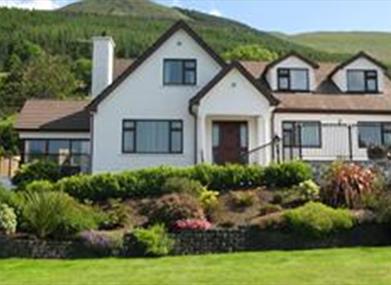
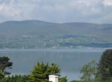
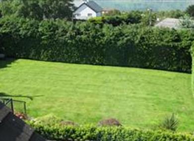
Overlooking Carlingford Lough, Fir Trees is a modern bungalow near Kilbroney Park.

Forest walks are accessible from the house and dogs are allowed outside. Private parking, laundry facilities, and wi-fi available. Tea coffee on arrival. Tv lounge.

Facilities

Children & Infants

  • Cot & Highchair Available

Establishment Features

  • Laundry Service

Leisure Facilities

  • Wifi

Parking & Transport

  • On site parking

Payment Methods

  • All major credit/debit cards accepted
  • Euros accepted

Provider Preferences

  • Dogs Welcome Outside
  • Family Room on request

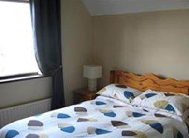
Room / Unit Features

  • Ground floor bedrooms available
  • Hairdryer Available
  • Ironing Facilities
  • Tea & coffee making facilities
  • TV In Bedrooms

Add Fir Trees to your Itinerary

Check availability for Fir Trees (opens in a new window)

Close window

Call direct on:

Tel +44 (0) 28 417 38602

Map & Directions

What's Nearby

  1. This beautiful area has superb views and good walking routes over Carlingford Lough.…

    1.03 miles away
  2. Kilbroney Park features riverside walks and an arboretum. There is a two-mile forest…

    1.24 miles away
  3. 'Cill Bhronaigh', or Bronagh’s Church (12th century), is located in the graveyard just…

    2.22 miles away
  1. Warrenpoint Beach is located alongside the Mourne Mountains on the shores of Carlingford…

    3.06 miles away
  2. Our play farm offers a huge indoor soft play area with four dragon slides and a massive…

    3.11 miles away
  3. Commanding the mouth of Carlingford Lough, the Castle has an eventful history. It was…

    4.3 miles away
  4. Excellent example of a tower-house and bawn built about 1568 at a point where the Newry…

    4.58 miles away
  5. "Where the Mountains of Mourne sweep down to the sea" (Percy French)

    The popular song…

    5.5 miles away
  6. Cranfield West offers a gently sloping, mainly sandy beach located at the entrance to…

    5.6 miles away
  7. Known locally as the ‘King’s Ring’, this court tomb has a prominent position in the…

    6.11 miles away
  8. Provides a first class service for visitors to Northern Ireland and for local residents.

    7.47 miles away
  9. The Nautilus Centre overlooks Kilkeel's busy and picturesque fishing port and houses the…

    7.57 miles away
  10. The Silent Valley Reservoir was built to gather water from the Mourne Mountains and is…

    7.79 miles away
  11. Kilnassagart Inscribed Stone, in the south of County Armagh, is regarded as being one of…

    8.03 miles away
  12. South of the County Armagh village of Jonesborough lie the ruins of Moyry Castle, built…

    8.3 miles away
  13. Spelga Dam Reservoir sits in the heart of the Mourne Mountains, located approximately 10…

    8.46 miles away
Previous Next

Map & Directions

View Maps and Visitor Guides
View what the Mourne Mountains & Ring of Gullion has to offer and some of the best things to see and do during a visit.
E-newsletter sign up
Sign up for the Mourne Mountains & Ring of Gullion newsletter for inspiration and travel tips.
Back to Top

Visit Mourne

Tourism Northern Ireland

Geopark

>

Don't Miss